- Type
- Lesson plan
- Ages
- Ages 11-13
- Skills
- Critical thinking
How can relative coordinate commands be used to design and build a functional roadway across uneven terrain?
Overview
Civil engineering requires balancing terrain constraints, elevation changes, and practical construction methods. In this challenge, students act as engineers tasked with connecting two isolated mining camps, turning spatial planning into precise computational commands using coordinate mathematics.
Using Minecraft Education and Code Builder, students learn relative coordinates to manipulate blocks across three dimensions. By executing fill commands with cobblestone and air, learners pave ground-level paths across plains, erect a bridge over a river, and excavate a mountain tunnel to complete the roadway.
Learning objectives
By the end of this lesson students will be able to:
- Apply relative coordinate axes (x, y, z) to define three-dimensional cubic volumes.
- Construct a connected cobblestone road between two mining camps using the fill command.
- Excavate a tunnel through rock by running fill commands with air blocks.
- Evaluate road designs to navigate elevation changes, river crossings, and mountainous terrain.
Blocks and items used in this lesson


Key vocabulary
- Relative Position
- A coordinate location measured in distance from the player's current position along the x, y, and z axes.
- Fill Command
- A command that places or replaces blocks across a specified three-dimensional cubic region.
- Air Block
- A non-solid block type used in commands to clear space, remove obstacles, or bore tunnels.
- Operators
- Command parameters such as replace, hollow, outline, keep, and destroy that modify how blocks are filled.
Before class
Lesson sequence
- Coordinate System Review
Review how longitude (x), elevation (y), and latitude (z) operate in Minecraft. Explain that the fill command defines a 3D cubic volume relative to player position and can place solid materials or air blocks.
- Site Survey and Route Planning
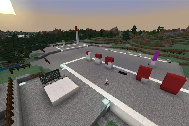
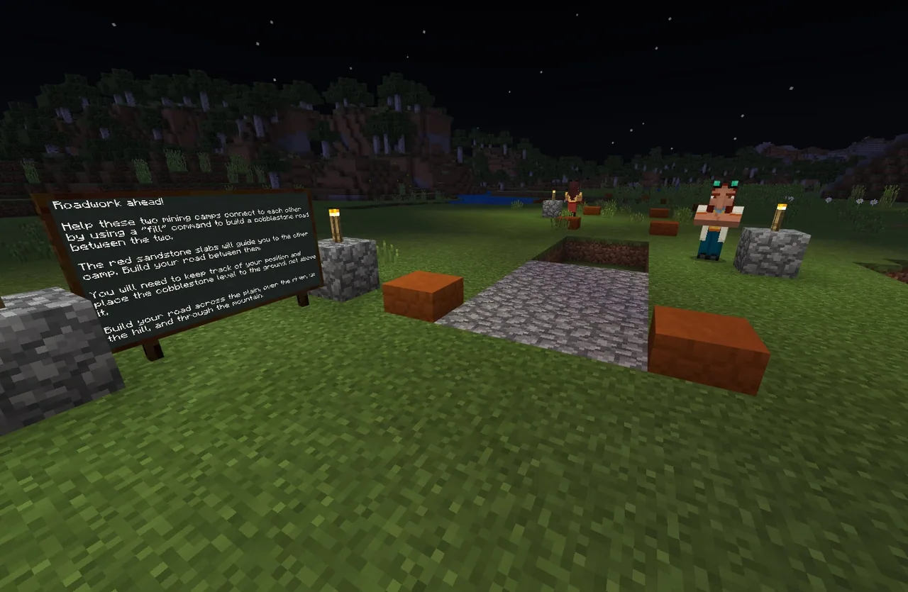
Have students load into the world in pairs, find the first campsite, and inspect the sample road bed. Direct them to follow the red sandstone slabs that mark the planned route toward the second camp.
- Road Construction and Excavation
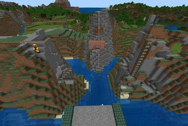
Students write and run fill commands to lay cobblestone flush with the ground. As the terrain shifts, pairs must modify their coordinates to build a bridge across the river, ascend hills, and replace solid stone with air blocks to tunnel through the mountain.
- Command Optimization
Encourage students to test and customize their roadway using command operators like replace, hollow, outline, keep, or destroy to solve construction challenges efficiently.
- Debrief and Evaluation
Gather the class to discuss their solutions. Have pairs share which road segment was most challenging, how placing air differs from solid blocks, and how the fill command simplified large-scale building.
Assessment: success criteria
- A continuous cobblestone roadway links the starting camp to the destination camp.
- The road surface rests flush at ground level across flat ground and adjusts cleanly to elevation changes.
- A bridge successfully spans the river and a tunnel bored with air blocks passes through the mountain.
- Students can explain how relative coordinates and cubic volumes function in their fill commands.
Differentiation
Provide graph paper to help students map out relative x, y, and z offsets visually before typing commands into Code Builder.
Challenge students to incorporate advanced operators such as replace, hollow, outline, keep, or destroy to add specialized structures along their route.
Knowledge check
5 questions to check understanding after the lesson. Tap an answer to see if it is right; the score appears at the end.
1Which Minecraft command is used in this lesson to place large quantities of blocks at once?
Answer: B. The lesson centers on using the fill command to build road segments quickly.
2How do students bore a tunnel through the mountain during the construction project?
Answer: A. The source notes that students use the fill with air command to hollow out tunnels through solid rock.
3What markers are placed in the world to help guide students toward their destination?
Answer: B. The source states that red sandstone slabs guide players to the destination.
4In the Minecraft coordinate system, which axis represents elevation?
Answer: C. The guiding ideas explain that elevation corresponds to the y-coordinate.
5Which of the following is an operator students can investigate to customize their fill commands?
Answer: D. The source identifies replace, hollow, outline, keep, and destroy as operators students can explore.
Resources
- Lesson package (.zip)Everything the author attached to this lesson in one download.
- World FileWorld file for student use
Part of the Code for STEM curriculum
This is lesson 14 of 20 in Code for STEM.
- 3-D Fractions
- Aquarium
- Build a Dam
- Canyon Arch Bridge
- Chicken or the Egg
- Creeper Tower Test
- Energy Transfer
- Forces
- Hour of Code: AI for Good
- Minecraft Code Town
- Molecules
- Number Line Railroad
- Plate Motions
- Road Construction Ahead
- Scale
- Slope
- Surface Area and Perimeter
- Units of Measurement
- Walled Fortress
- Wave Properties
Frequently Asked Questions
What material must students use to build the roadway?
Students are instructed to construct the road bed using cobblestone placed at ground level.
Why is scratch paper recommended for this lesson?
Scratch or graph paper helps students sketch coordinates and calculate 3D block volumes relative to their player position before executing commands.
What major terrain obstacles must students solve along the route?
Students must adapt their commands to traverse plains, cross a river with a bridge, climb a hill, and tunnel through solid mountain rock.
Adapted from Road Construction Ahead by John Miller on Minecraft Education, last updated Jul 14, 2022. This classroom version, the timings and the quiz were written by 9Minecraft Education.