- Type
- Lesson plan
- Subject
- History & Social Studies
- Topics
- Geography
- Ages
- Ages 11-13
- Duration
- about 2 hours (suggested)
- Includes
- Quiz: 5 questions
How do Australia's global connections and cultural differences shape our perceptions of places across the world?
Overview
This geography project prompts students to investigate the connections between Australia and Malaysia while exploring intercultural understanding across the Asia region. Before building, learners record their initial impressions of both nations, then investigate real-world geographic data, indigenous communities, and bilateral relationships to evaluate how connections to places shape human perception.
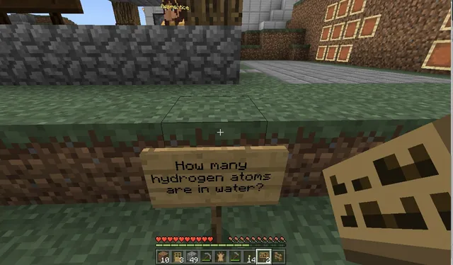
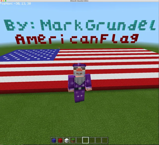
Working collaboratively in Minecraft, students use Google Maps to recreate scaled national maps, official flags, and significant monuments. Teams document demographic data, spoken languages, and traded goods on in-game signs before touring the opposite group's build and presenting a comparative analysis of both countries.
Learning objectives
By the end of this lesson students will be able to:
- Construct a scaled map, official flag, and significant monument using Google Maps as an inquiry guide.
- Document state-level population figures, spoken languages, and international trade items on signs in Minecraft.
- Compare geographic, demographic, and cultural similarities and differences between Australia and Malaysia.
- Re-evaluate initial perceptions of both nations based on peer findings, trade links, and landmark research.
Blocks and items used in this lesson


Key vocabulary
- Perception
- An individual's personal view, belief, or understanding of a place or culture.
- Bilateral trade
- The commercial exchange of goods and services between two specific nations.
- Scale
- The ratio used to represent real-world proportions accurately within a model or map.
- Intercultural understanding
- The ability to recognize, respect, and learn from diverse cultures and perspectives.
Before class
Lesson sequence
Suggested timing: about 120 minutes in total.
- Initial Perceptions Review15 min
Review the initial perceptions students recorded prior to the lesson. Introduce the driving questions around global connections, trade, and cultural diversity between Australia and Malaysia.
- Research and Scaled Construction60 min
Groups work in their assigned country world using Google Maps to build three core elements:
- A scaled replica of the national flag.
- A significant cultural or historical monument.
- A scaled territory map with state boundaries.
Within each state, students place signs detailing population counts, spoken languages, and products traded with the counterpart country.
- Cross-Country World Tour20 min
Students visit the virtual builds created by the other group. Learners inspect the opposite country's monuments, state data signs, and flags to record similarities and differences between Australia and Malaysia.
- Class Discussion and Synthesis25 min
Hold a whole-class discussion where groups share their observations. Students re-examine their original perceptions and record an updated viewpoint based on what they learned about trade, language, and cultural monuments.
Assessment: success criteria
- Scale accuracy of the completed national map, flag, and selected monument.
- Presence of informative signs in each state listing population, spoken languages, and traded products.
- Screenshots or screen recordings submitted showing collaborative progress in Minecraft.
- A final recorded presentation explaining the similarities, differences, and revised perceptions of both nations.
Differentiation
Provide learners with pre-selected Google Maps links and structured trade data sheets to guide their state signage.
Have students research and represent indigenous peoples and specialized regional export industries in each state.
Knowledge check
5 questions to check understanding after the lesson. Tap an answer to see if it is right; the score appears at the end.
1Which two countries do students compare and construct during the project?
Answer: C. The lesson specifically focuses on Australia and its connections with Malaysia.
2What specific data must students include on signs placed within each state?
Answer: A. The source requires each state to feature stats for population, spoken languages, and bilateral traded products.
3Which tool are students instructed to use to research landmarks and scaled maps?
Answer: D. The activities state that students use Google Maps to research monuments and build scaled maps.
4What do students do immediately after completing their assigned country's build?
Answer: B. Learners are given the opportunity to explore the country they were not allocated to compare both nations.
5What task concludes the learning sequence after the whole-class discussion?
Answer: C. Students reanalyse their interpretation and record a new perception incorporating what they learned.
Frequently Asked Questions
Does this lesson require an official pre-made Minecraft world file?
No downloadable world file is required. Students can build directly in a standard or flat world using Google Maps as their reference.
How can teachers track student progress during the build phases?
Teachers can collect screenshots or screencasts showing build progress, followed by a final digital presentation comparing both nations.
Adapted from A DIVERSE AND CONNECTED WORLD by Courtney McAndrew on Minecraft Education, last updated Jul 10, 2018. This classroom version, the timings and the quiz were written by 9Minecraft Education.